|
|
| 08/18/13 |
|
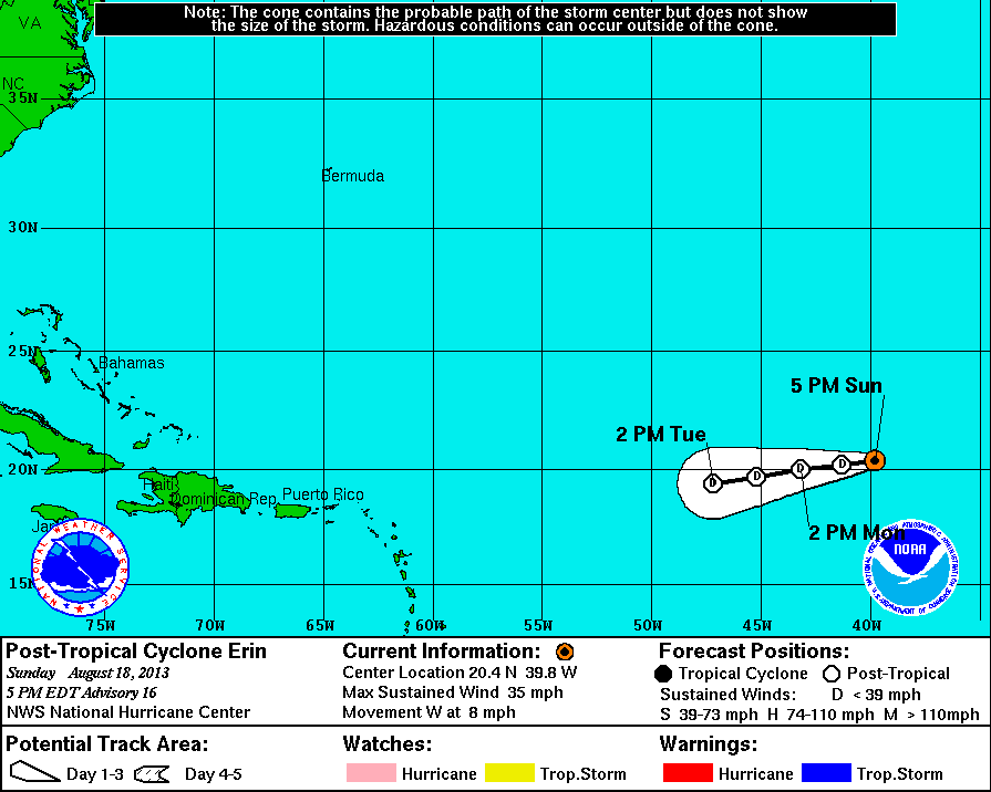
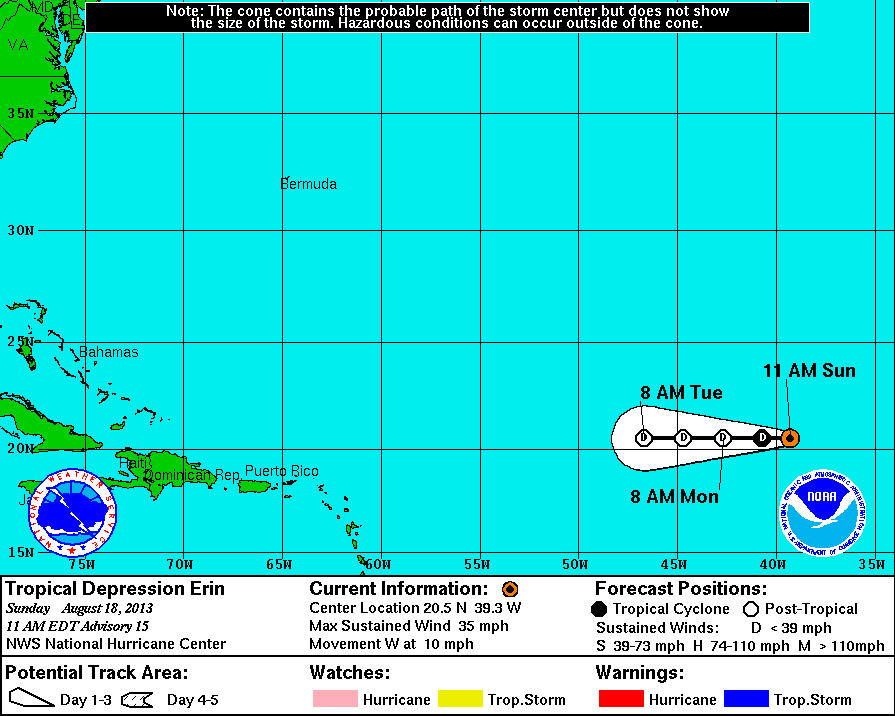
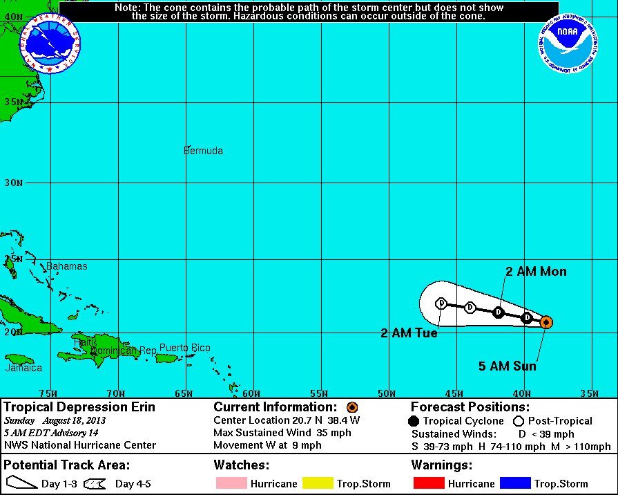
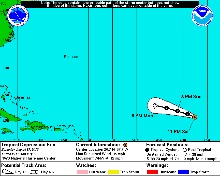
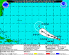
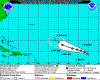
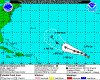
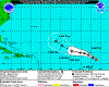
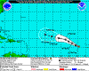
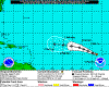
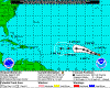
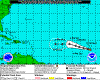
Erin was born 8/14 over the east Atlantic and soon became a tropical storm, wandering around before degenerating 8/18.
|
 |
2013-08-18
1700 EDT
Post-Tropical
Cyclone
35 mph
W at 8 mph |
|
 |
2013-08-18
1100 EDT
Tropical
Depression
35 mph
W at 10 mph |
|
 |
2013-08-18
0500 EDT
Tropical
Depression
35 mph
W at 9 mph |
|
 |
2013-08-17
2300 EDT
Tropical
Depression
35 mph
WNW at 12 mph |
|
 |
2013-08-17
1700 EDT
Tropical
Storm
40 mph
NW at 13 mph |
|
 |
2013-08-17
1100 EDT
Tropical
Storm
40 mph
NW at 12 mph |
|
 |
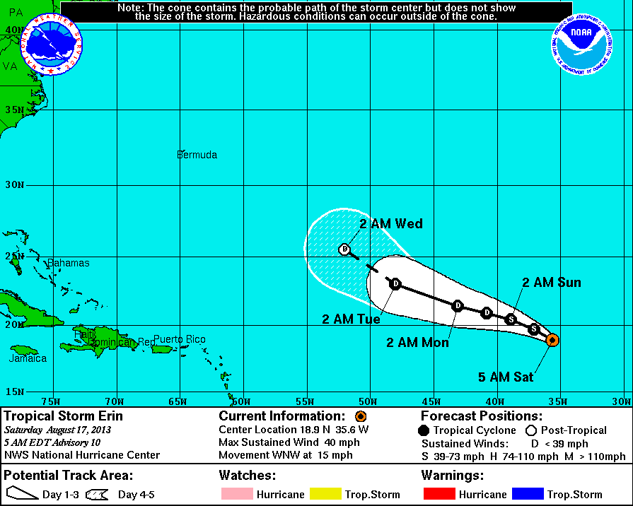
2013-08-17
0500 EDT
Tropical
Storm
40 mph
WNW at 15 mph |
|
|
 |
2013-08-16
1700 EDT
Tropical
Depression
35 mph
WNW at 17 mph |
|
 |
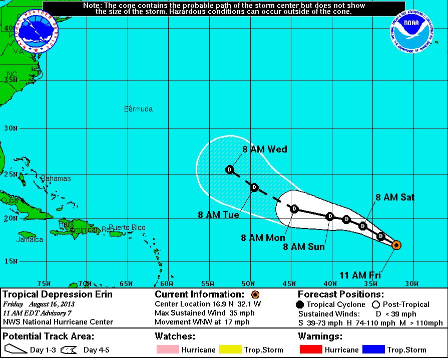
2013-08-16
1100 EDT
Tropical
Depression
35 mph
WNW at 17 mph |
|
 |
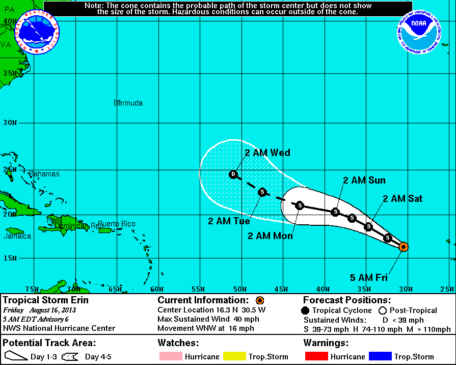
2013-08-16
0500 EDT
Tropical
Storm
40 mph
WNW at 16 mph |
|
 |
2013-08-15
2300 EDT
Tropical
Storm
40 mph
WNW at 15 mph |
|
 |
2013-08-15
1700 EDT
Tropical
Storm
40 mph
WNW at 14 mph |
|
 |
2013-08-15
1100 EDT
Tropical
Storm
40 mph
WNW at 15 mph |
|
 |
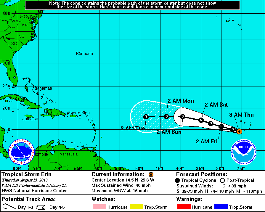
2013-08-15
0800 EDT
Tropical
Storm
40 mph
WNW at 16 mph |
|
 |
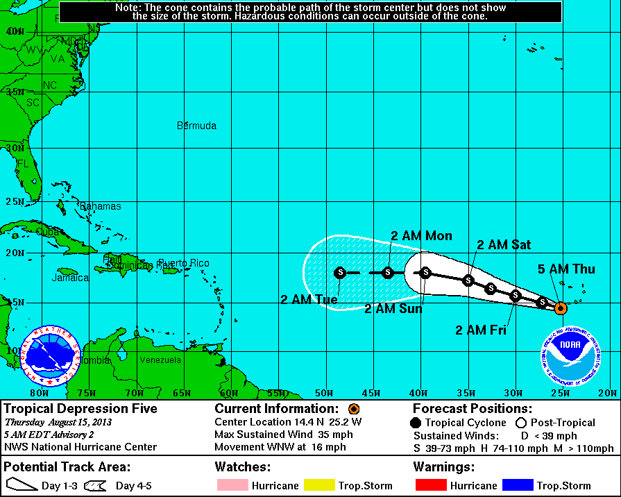
2013-08-15
0500 EDT
Tropical
Depression
35 mph
WNW at 16 mph |
|
 |
2013-08-14
2300 EDT
Tropical
Depression
35 mph
WNW at 14 mph |
|
|
| |