|
|
|
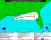
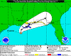
11/02/14
|
|
1000 ...KAREN DISSIPATES...THIS IS THE LAST ADVISORY...
|
 |
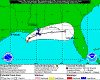
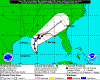
2013-10-06
1000 CDT
Remnants
30 mph
E at 13 mph |
|
 |
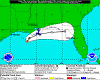
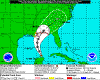
2013-10-06
0400 CDT
Tropical
Depression
30 mph
NE at 2 mph |
|
 |
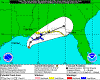
2013-10-05
2200 CDT
Tropical
Depression
35 mph
Stationary |
|
 |
2013-10-05
1900 CDT
Tropical
Storm
40 mph
Stationary |
|
 |
2013-10-05
1600 CDT
Tropical
Storm
40 mph
N at 2 mph |
|
 |
2013-10-05
1300 CDT
Tropical
Storm
40 mph
Stationary |
|
 |
2013-10-05
1000 CDT
Tropical
Storm
40 mph
N at 7 mph |
|
|
 |
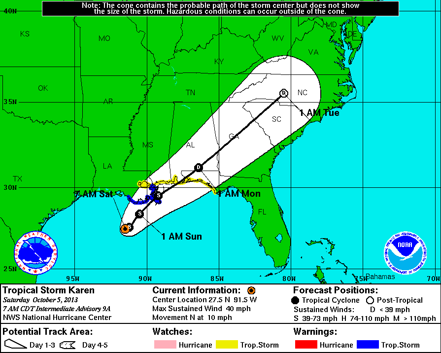
2013-10-05
0700 CDT
Tropical
Storm
40 mph
N at 10 mph |
|
 |
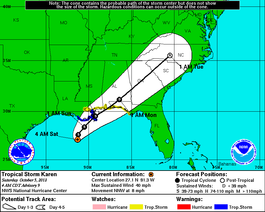
2013-10-05
0400 CDT
Tropical
Storm
40 mph
NNW at 8 mph |
|
 |
2013-10-04
1600 CDT
Tropical
Storm
50 mph
NNW at 7 mph |
|
 |
2013-10-04
1000 CDT
Tropical
Storm
50 mph
NNW at 10 mph |
|
 |
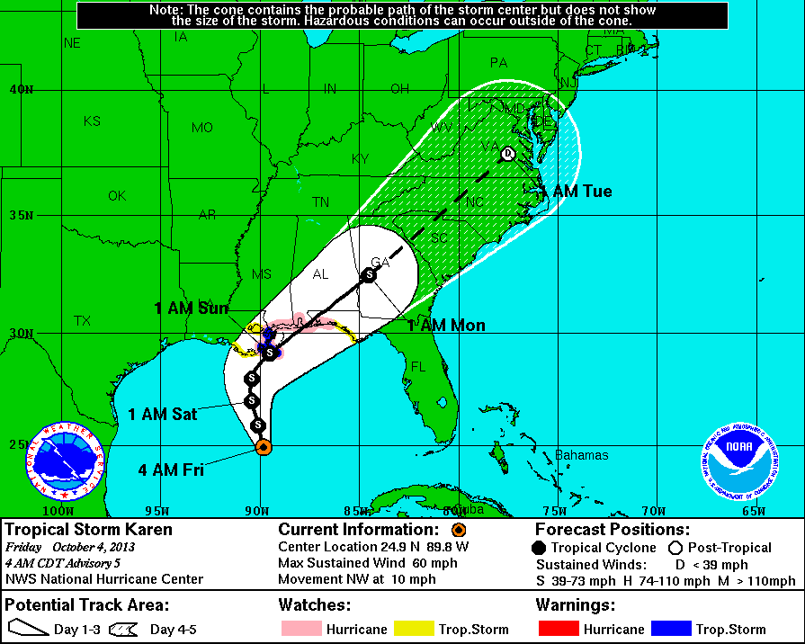
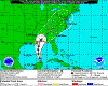
2013-10-04
0400 CDT
Tropical
Storm
60 mph
NW at 10 mph |
|
 |
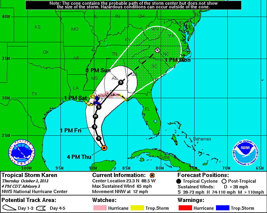
2013-10-03
1600 CDT
Tropical
Storm
65 mph
NNW at 12 mph |
|
 |
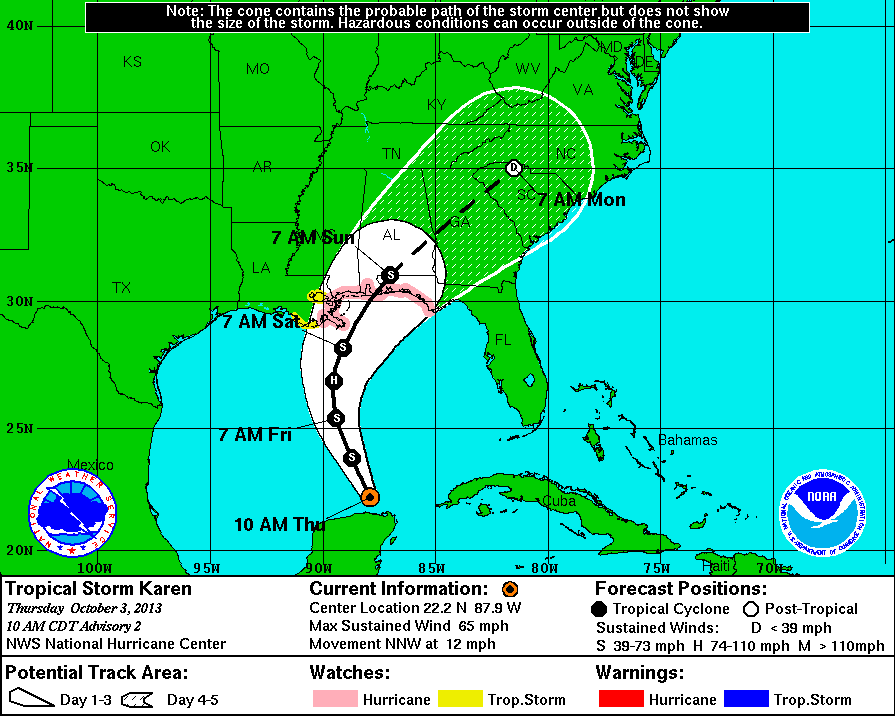
2013-10-03
1000 CDT
Tropical
Storm
65 mph
NNW at 12 mph |
|
 |
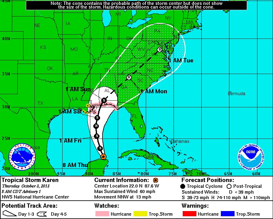
2013-10-03
0800 CDT
Tropical
Storm
60 mph
NNW at 13 mph |
|
|
|
|