|
|
|
08/17/2017 |
|
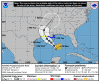
1100 ...HEAVY RAINFALL ASSOCIATED WITH CINDY IS QUICKLY MOVING OFF THE SOUTHERN NEW ENGLAND COAST...
|
 |
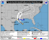
2017-06-22
1000 CDT
Tropical
Depression
35 mph
N at 13 |
|
 |
2017-06-22
0400 CDT
Tropical
Storm
40 mph
N at 12 |
|
 |
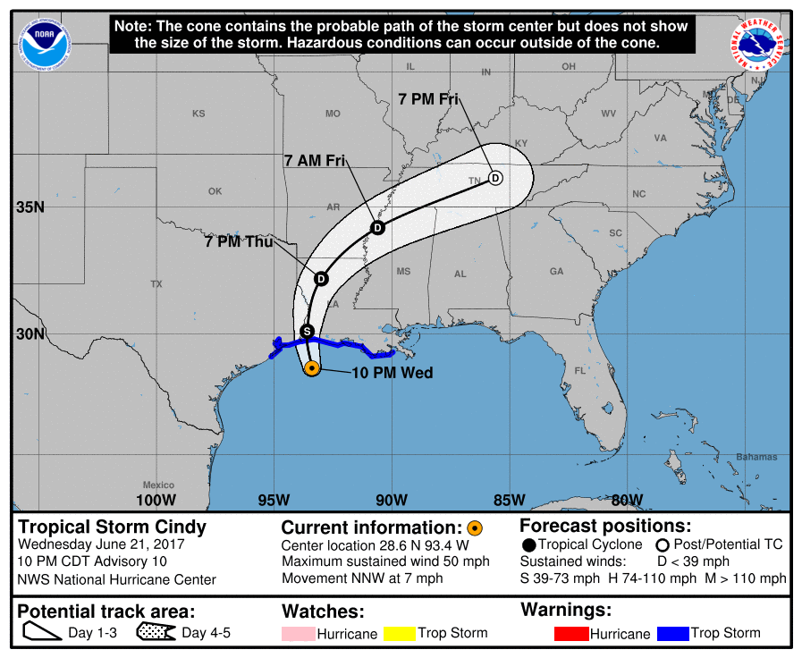
2017-06-21
2200 CDT
Tropical
Storm
50 mph
NNW at 7 |
|
|
 |
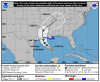
2017-06-21
1600 CDT
Tropical
Storm
50 mph
NW at 9 |
|
 |
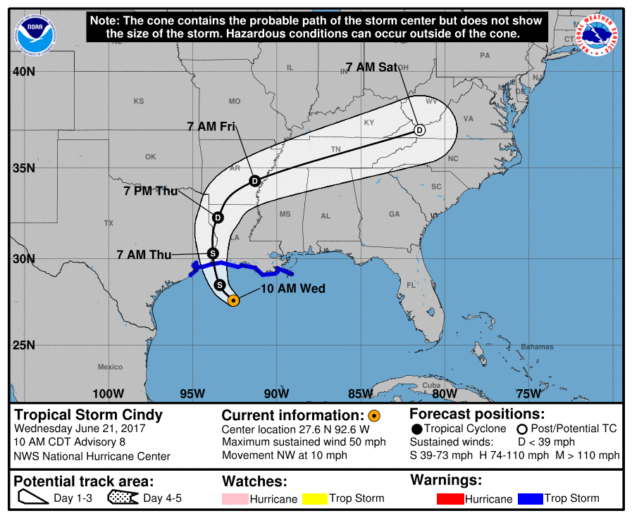
2017-06-21
1000 CDT
Tropical
Storm
50 mph
NW at 10 |
|
 |
2017-06-21
0400 CDT
Tropical
Storm
60 mph
NW at 8 |
|
 |
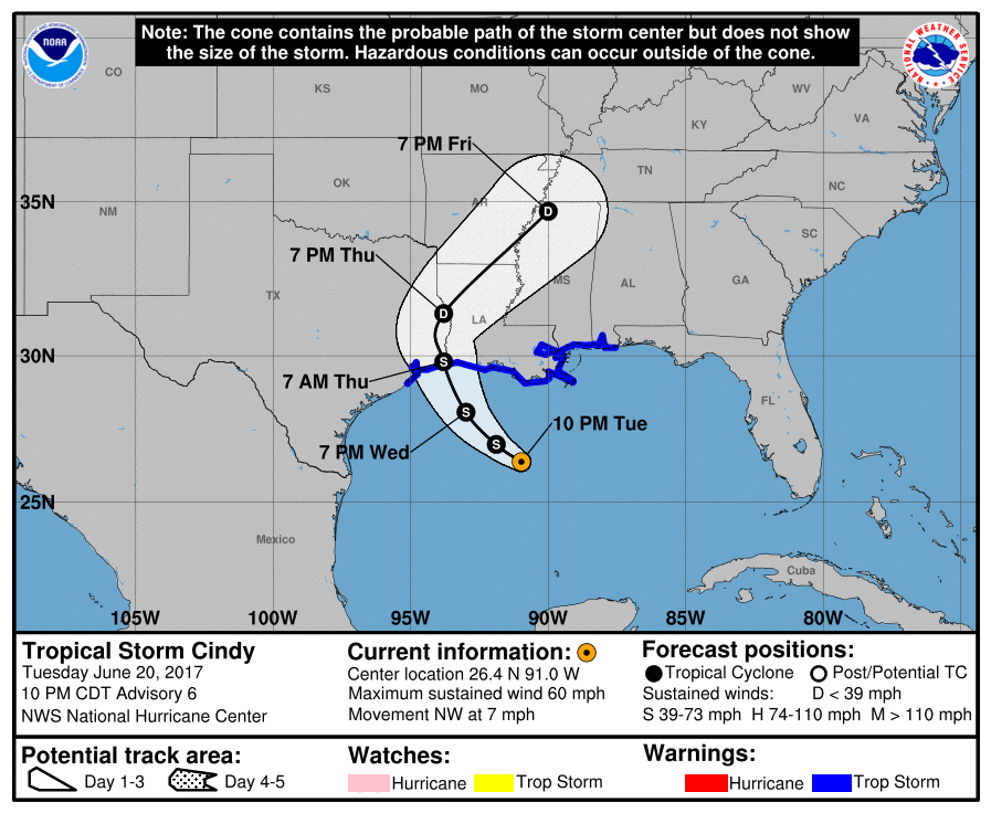
2017-06-20
2200 CDT
Tropical
Storm
60 mph
NW at 7 |
|
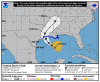 |
2017-06-20
1600 CDT
Tropical
Storm
45 mph
Stationary |
|
 |
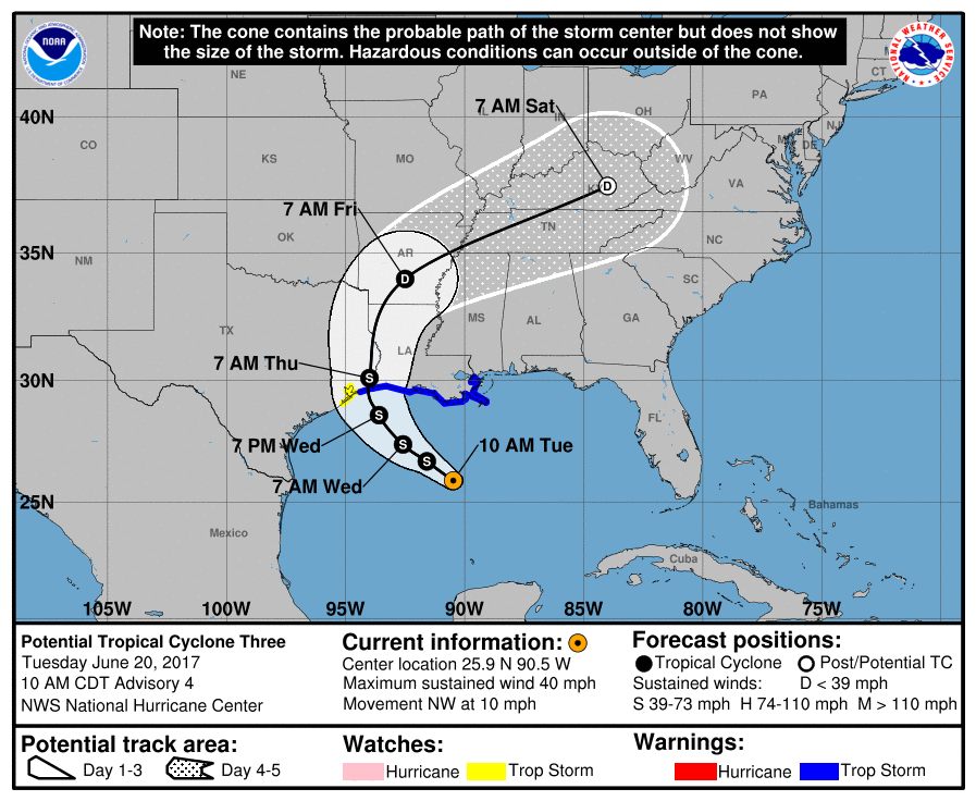
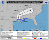
2017-06-20
1000 CDT
Potential
Tropical
Cyclone
40 mph
NW at 10 |
|
 |
2017-06-20
0400 CDT
Potential
Tropical
Cyclone
40 mph
NW at 8 |
|
 |
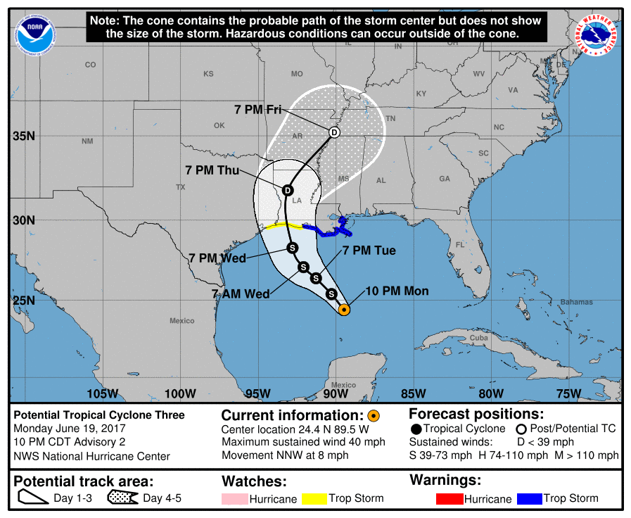
2017-06-19
2200 CDT
Potential
Tropical
Cyclone
40 mph
NNW at 8 |
|
 |
2017-06-19
1600 CDT
Potential
Tropical
Cyclone
40 mph
N at 9 |
|
|
|
|