|
|
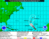
| 09/24/2016 |
|
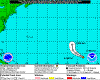
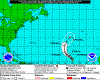
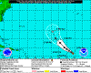
2300...POST-TROPICAL LISA LACKS DEEP CONVECTION...THIS IS THE LAST ADVISORY...
|
 |
2016-09-24
2300 EDT
Post-Tropical
Cyclone
35 mph
NW at 12 |
|
 |
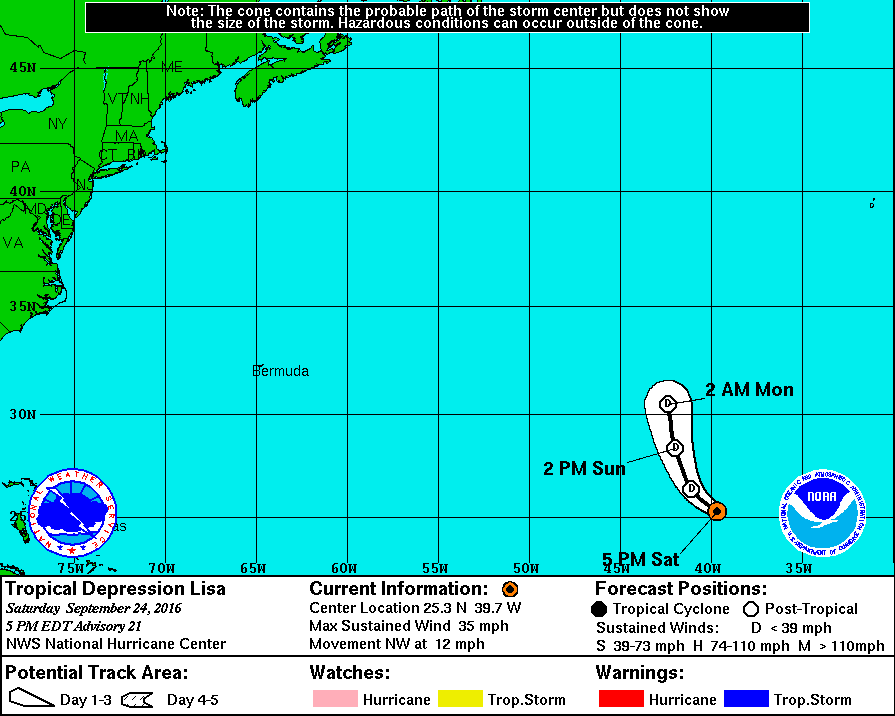
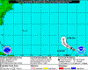
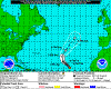
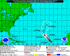
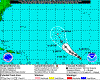
2016-09-24
1700 EDT
Tropical
Depression
35 mph
NW at 12 |
|
|
 |
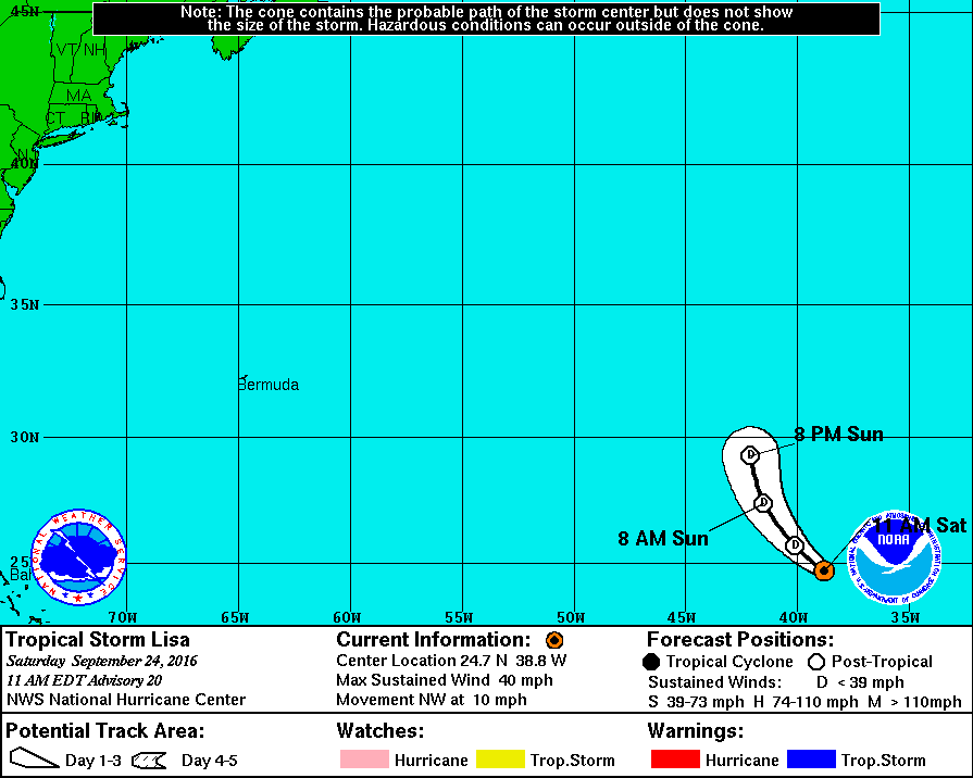
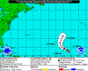
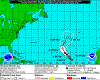
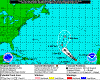
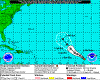
2016-09-24
1100 EDT
Tropical
Storm
40 mph
NW at 10 |
|
 |
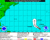
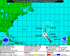
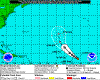
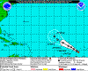
2016-09-24
0500 EDT
Tropical
Depression
35 mph
NW at 9 |
|
 |
2016-09-23
2300 EDT
Tropical
Depression
35 mph
NW at 8 |
|
 |
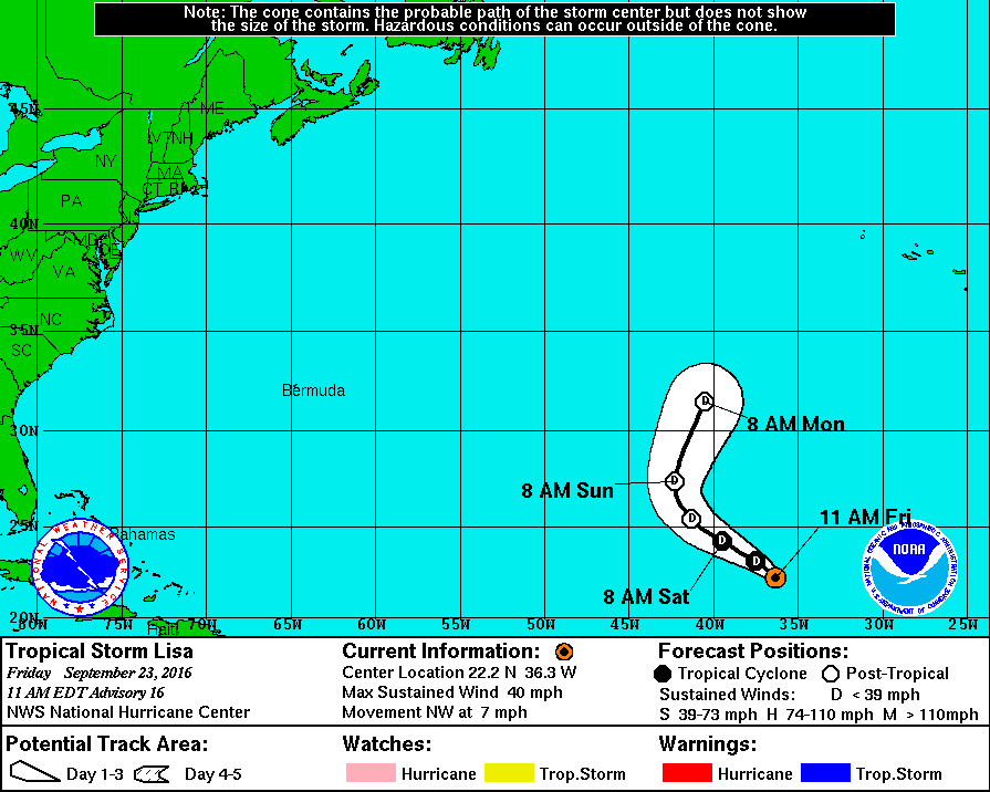
2016-09-23
1700 EDT
Tropical
Depression
35 mph
NW at 7 |
|
 |
2016-09-23
1100 EDT
Tropical
Storm
40 mph
NW at 7 |
|
 |
2016-09-23
0500 EDT
Tropical
Storm
40 mph
NW at 9 |
|
 |
2016-09-22
2300 EDT
Tropical
Storm
45 mph
NW at 9 |
|
 |
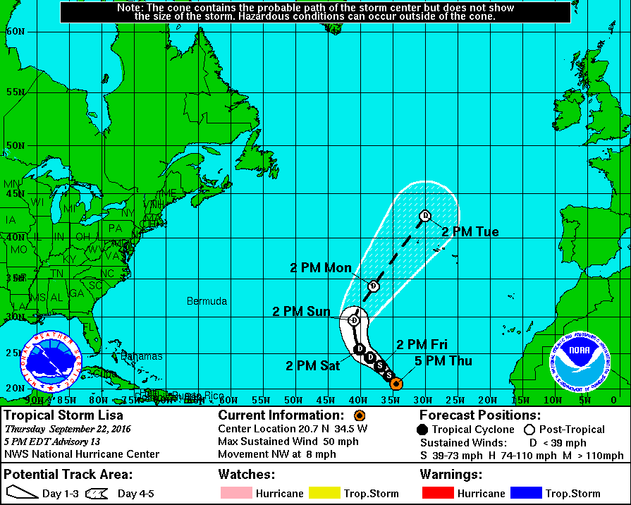
2016-09-22
1700 EDT
Tropical
Storm
50 mph
NW at 8 |
|
 |
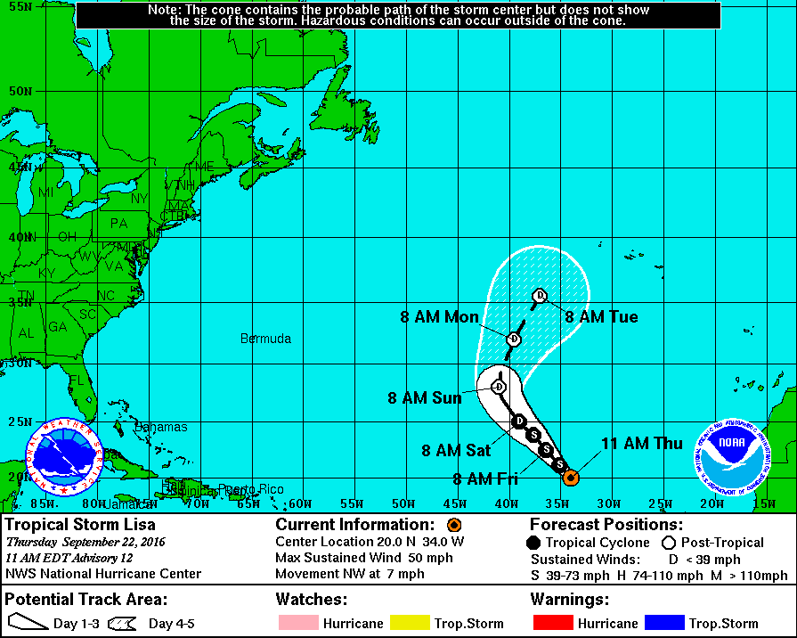
2016-09-22
1100 EDT
Tropical
Storm
50 mph
NW at 7 |
|
 |
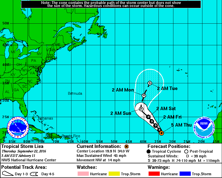
2016-09-22
0500 EDT
Tropical
Storm
45 mph
NW at 14 |
|
|
 |
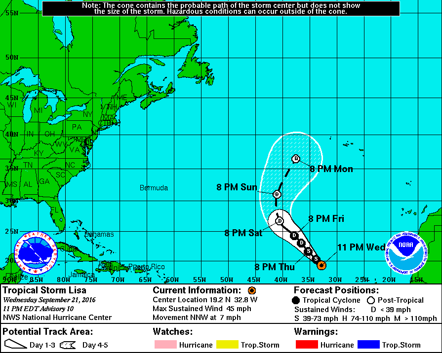
2016-09-21
2300 EDT
Tropical
Storm
45 mph
NNW at 7 |
|
 |
2016-09-21
1700 EDT
Tropical
Storm
45 mph
NW at 7 |
|
 |
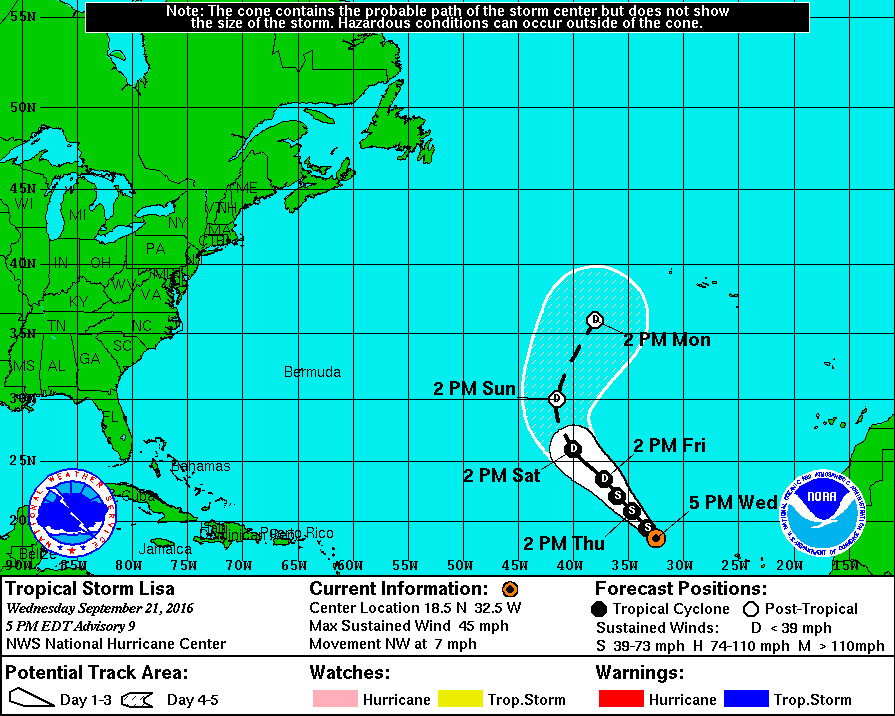
2016-09-21
1100 EDT
Tropical
Storm
50 mph
NW at 8 |
|
 |
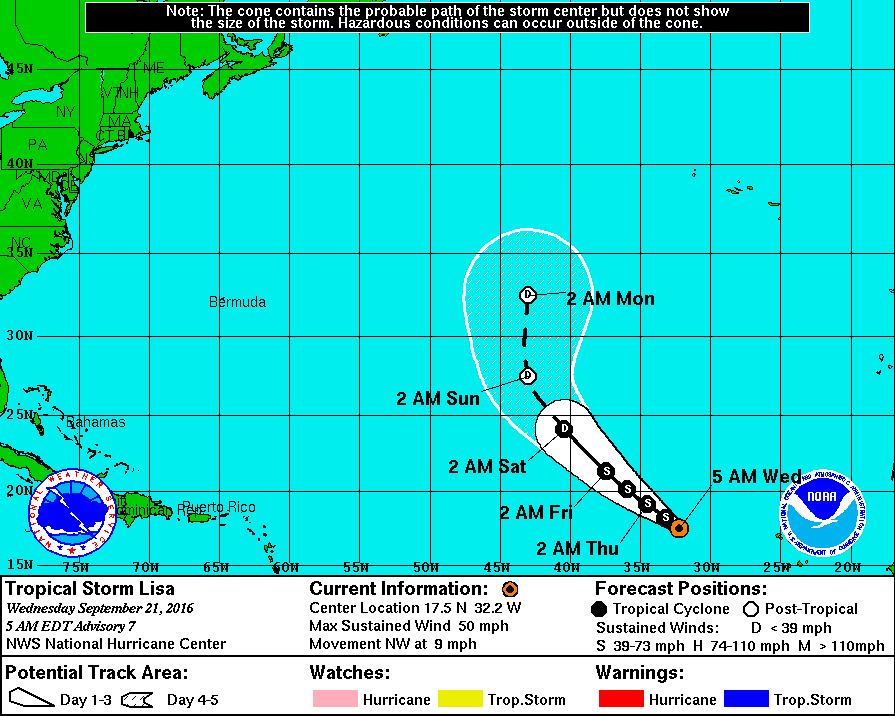
2016-09-21
0500 EDT
Tropical
Storm
50 mph
NW at 9 |
|
 |
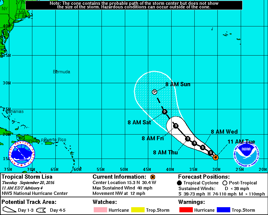
2016-09-20
2300 EDT
Tropical
Storm
45 mph
NW at 10 |
|
 |
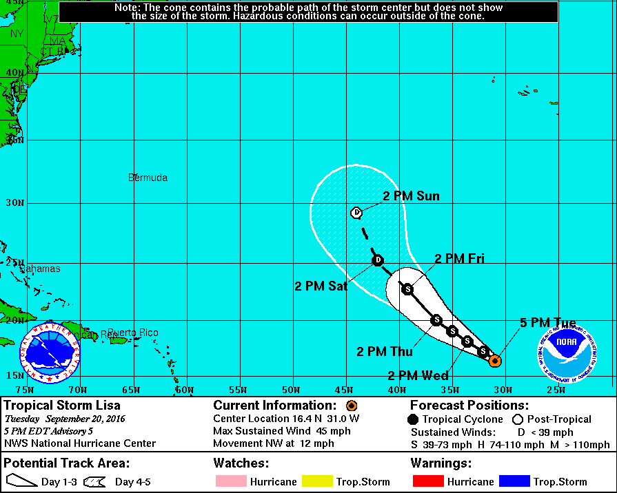
2016-09-20
1700 EDT
Tropical
Storm
45 mph
NW at 12 |
|
 |
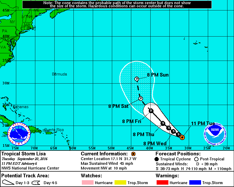
2016-09-20
1100 EDT
Tropical
Storm
40 mph
NW at 12 |
|
 |
2016-09-20
0500 EDT
Tropical
Depression
35 mph
WNW at 9 |
|
 |
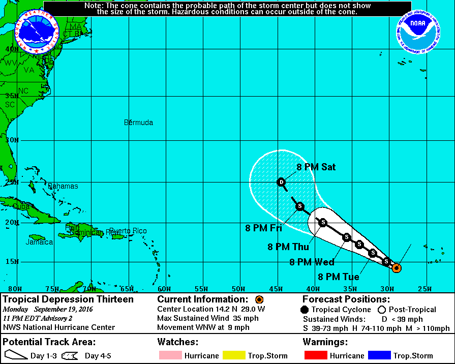
2016-09-19
2300 EDT
Tropical
Depression
35 mph
WNW at 9 |
|
 |
2016-09-19
1700 EDT
Tropical
Depression
35 mph
W at 12 |
|
|
|
|
|