|
|
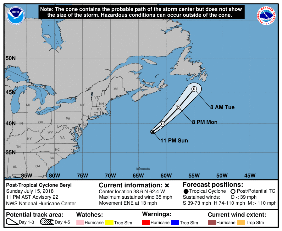
| 07/15/2018 |
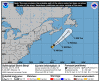
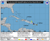
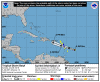
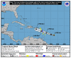
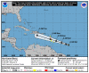
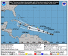
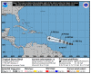
2300...BERYL BECOMES A REMNANT LOW...THIS IS THE LAST ADVISORY...
Beryl was born 7/5 over the central tropical Atlantic, moving toward the Lesser Antilles.
Early on the 6th, he became a hurricane.
By the 7th, he was weakening and late on the 8th fell apart, but on the 14th, he was back.
|
 |
2018-07-15
2300 AST
Post-Tropical
Storm
25 mph
ENE at 13 mph |
|
 |
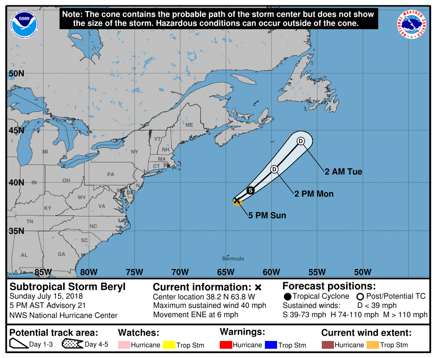
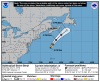
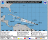
2018-07-15
1700 AST
Subtropical
Storm
40 mph
ENE at 6 mph |
|
 |
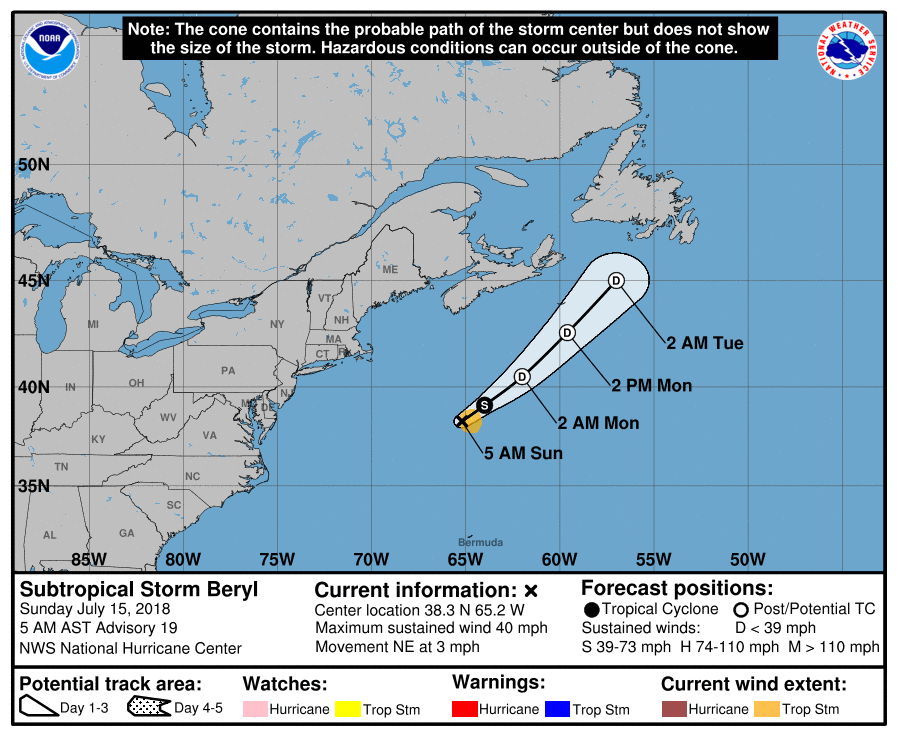
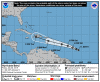
2018-07-15
1100 AST
Subtropical
Storm
40 mph
ENE at 3 mph |
|
 |
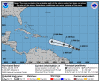
2018-07-15
0500 AST
Subtropical
Storm
40 mph
NE at 3 mph |
|
 |
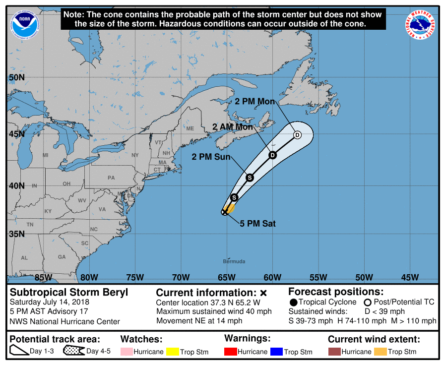
2018-07-14
1700 AST
Subtropical
Storm
40 mph
NE at 14 mph |
|
 |
2018-07-14
1300 AST
Subtropical
Storm
40 mph
NE at 12 mph |
|
|
 |
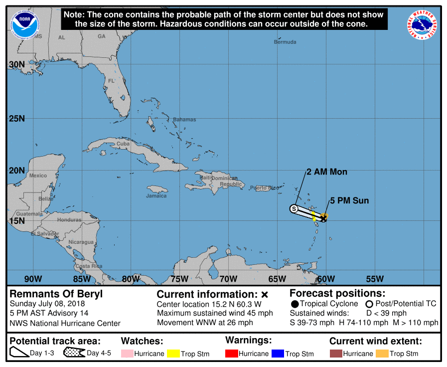
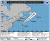
2018-07-08
1700 AST
Remnants
45 mph
WNW at 26 mph |
|
 |
2018-07-08
1100 AST
Tropical
Storm
45 mph
WNW at 23 mph |
|
 |
2018-07-08
0500 AST
Tropical
Storm
45 mph
WNW at 20 mph |
|
|
 |
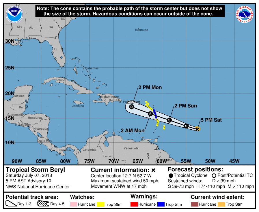
2018-07-07
1700 AST
Tropical
Storm
50 mph
WNW at 17 mph |
|
 |
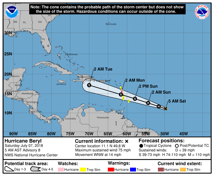
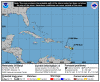
2018-07-07
0500 AST
Hurricane
75 mph
WNW at 14 mph |
|
 |
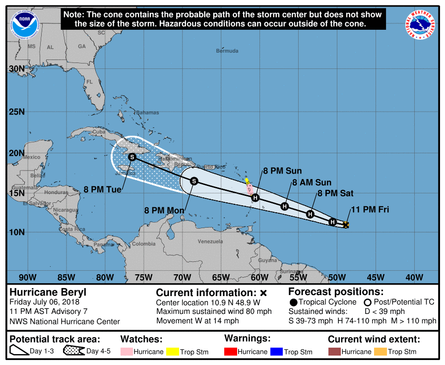
2018-07-06
2300 AST
Hurricane
80 mph
W at 14 mph |
|
 |
2018-07-06
1700 AST
Hurricane
80 mph
W at 15 mph |
|
 |
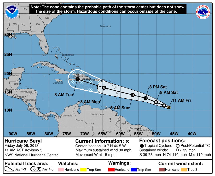
2018-07-06
1100 AST
Hurricane
80 mph
W at 15 mph |
|
 |
2018-07-06
0500 AST
Hurricane
75 mph
W at 14 mph |
|
 |
2018-07-05
2300 AST
Tropical
Storm
65 mph
W at 14 mph |
|
 |
2018-07-05
1700 AST
Tropical
Storm
50 mph
W at 16 mph |
|
 |
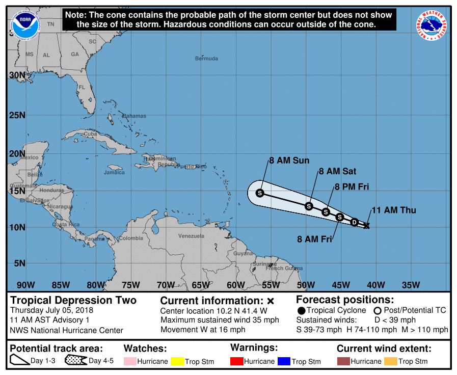
2018-07-05
1100 AST
Tropical
Depression
35 mph
W at 16 mph |
|
|
|
|